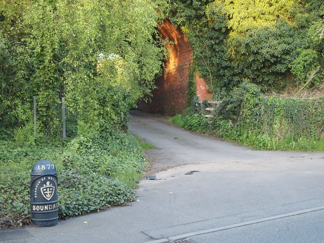
Nottingham - NG6 (Bestwood)
Introduction
The photograph on this page of Nottingham - NG6 (Bestwood) by David Hallam-Jones as part of the Geograph project.
The Geograph project started in 2005 with the aim of publishing, organising and preserving representative images for every square kilometre of Great Britain, Ireland and the Isle of Man.
There are currently over 7.5m images from over 14,400 individuals and you can help contribute to the project by visiting https://www.geograph.org.uk

Image: © David Hallam-Jones Taken: 16 May 2012
This turning off Bestwood Road (the B683), as one proceeds in the direction of Hucknall Road (the A611), passes under a former railway line. Nowadays the bridge carries a nature trail across this farm track ahead allowing walkers and cyclists to join the Robin Hood Trail nearer to Bestwood Village. An imaginary inverted U shaped loop encapsulates this boundary marker, tying it - and this stretch of the B683 - into the administrative jurisdiction of Nottingham City Council. The photograph was taken from a spot that lies within Ashfield Borough Council's territory. The territory to the left of this cast iron marker is controlled by Gedling Borough Council.

