A distant view of the Margam Mountain plateau
Introduction
The photograph on this page of A distant view of the Margam Mountain plateau by Jaggery as part of the Geograph project.
The Geograph project started in 2005 with the aim of publishing, organising and preserving representative images for every square kilometre of Great Britain, Ireland and the Isle of Man.

There are currently over 7.5m images from over 14,400 individuals and you can help contribute to the project by visiting https://www.geograph.org.uk
A distant view of the Margam Mountain plateau
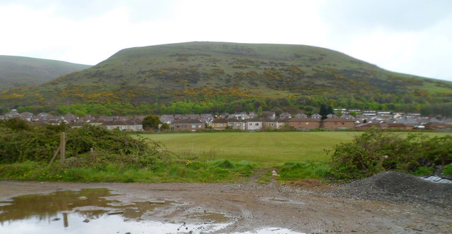
Image: © Jaggery Taken: 19 Apr 2012
Viewed from the edge of the South Wales main railway line http://www.geograph.org.uk/photo/2949570 looking towards Margam Road, which is the subject location of this view. The distant high ground is the Margam Mountain (Mynydd Margam) plateau. Some crests exceed 300m above mean sea level, the highest of which is Margam Mountain itself, at 342m.
Images are licensed for reuse under creativecommons.org/licenses/by-sa/2.0
Image Location
Latitude
51.576765
Longitude
-3.759081