Wellington Road South
Introduction
The photograph on this page of Wellington Road South by Gerald England as part of the Geograph project.
The Geograph project started in 2005 with the aim of publishing, organising and preserving representative images for every square kilometre of Great Britain, Ireland and the Isle of Man.

There are currently over 7.5m images from over 14,400 individuals and you can help contribute to the project by visiting https://www.geograph.org.uk
Wellington Road South
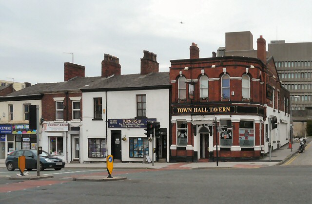
Image: © Gerald England Taken: 17 May 2012
Opposite the end of Railway Road. On the corner of John Street is the Town Hall Tavern Image Next door is Turners art shop http://www.turnersartshop.co.uk/index.asp which was established in 1895 as a chemists who mended broken fountain pens on the side. The next shop down is a nail bar.
Images are licensed for reuse under creativecommons.org/licenses/by-sa/2.0
Image Location
Latitude
53.40653
Longitude
-2.159407