The Lost Gateway
Introduction
The photograph on this page of The Lost Gateway by Dave Pickersgill as part of the Geograph project.
The Geograph project started in 2005 with the aim of publishing, organising and preserving representative images for every square kilometre of Great Britain, Ireland and the Isle of Man.

There are currently over 7.5m images from over 14,400 individuals and you can help contribute to the project by visiting https://www.geograph.org.uk
The Lost Gateway
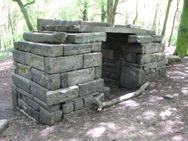
Image: © Dave Pickersgill Taken: 16 May 2012
'The Lost Gateway' is located near the Barrow Road entrance of Woolley Wood, an ancient woodland with a number of archaeological features. It was first documented in 1597 as ‘Woollywoodside.' The woodland was managed on a system of coppice with standards from the 16th century until the latter part of the 19th century, whereupon a system of ‘high forest’ was introduced, along with plantings of beech and hornbeam. The gateway is made from reclaimed stone and was recently constructed by Mick Humphries.
Images are licensed for reuse under creativecommons.org/licenses/by-sa/2.0
Image Location
Latitude
53.424925
Longitude
-1.422094