Top of the English Incline
Introduction
The photograph on this page of Top of the English Incline by Des Blenkinsopp as part of the Geograph project.
The Geograph project started in 2005 with the aim of publishing, organising and preserving representative images for every square kilometre of Great Britain, Ireland and the Isle of Man.

There are currently over 7.5m images from over 14,400 individuals and you can help contribute to the project by visiting https://www.geograph.org.uk
Top of the English Incline
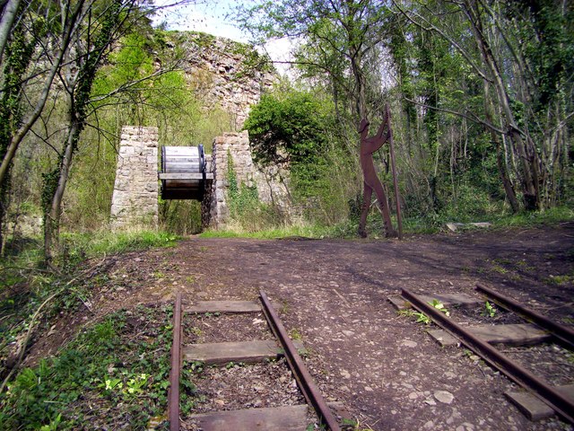
Image: © Des Blenkinsopp Taken: 25 Apr 2012
The England - Wales border goes through the middle of this large quarry. At one time two separate companies worked here, one English, one Welsh, each with their own tramways for getting the stone down from the quarry. This is the top of the incline on the English side, which became the only one to operate when the companies eventually combined. Descending full wagons pulled empty ones back up by a cable with the speed regulated via the big drum in the wheelhouse. The figure with the lever is the brake man, although apparently the job was often done by youngsters. If the cable snapped they had a few seconds to get to another lever which would divert the trucks off the incline half way down. If they didn't make it, as they sometimes didn't, then..err..oops. For a concise overview of the quarry history this pre visit info for teachers is pretty good. http://www.llanymynech.org.uk/html/1d_history.html
Images are licensed for reuse under creativecommons.org/licenses/by-sa/2.0
Image Location
Latitude
52.78796
Longitude
-3.088784