Proposed road, Greenisland (3)
Introduction
The photograph on this page of Proposed road, Greenisland (3) by Albert Bridge as part of the Geograph project.
The Geograph project started in 2005 with the aim of publishing, organising and preserving representative images for every square kilometre of Great Britain, Ireland and the Isle of Man.

There are currently over 7.5m images from over 14,400 individuals and you can help contribute to the project by visiting https://www.geograph.org.uk
Proposed road, Greenisland (3)
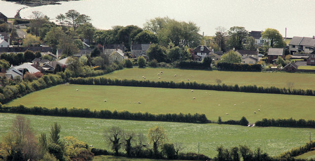
Image: © Albert Bridge Taken: 16 May 2012
The view from Knockagh war memorial Image towards the Shore Road, Greenisland. The proposed dual carriageway is due to run off-line from the Station Road to Seapark. My understanding, from the small scale map available, is that the road will pass towards the middle/bottom right and cross Whinfield Lane (the houses on the left) without affecting them. The map shows the north western end of Whinfield Lane crossing the dual carriageway by a bridge although whether it is a footbridge or a road bridge is not clear. The new road will then curve back towards the Shore Road at Seapark.
Images are licensed for reuse under creativecommons.org/licenses/by-sa/2.0
Image Location
Latitude
54.697649
Longitude
-5.855778