The Seacliff Road, Bangor
Introduction
The photograph on this page of The Seacliff Road, Bangor by Rossographer as part of the Geograph project.
The Geograph project started in 2005 with the aim of publishing, organising and preserving representative images for every square kilometre of Great Britain, Ireland and the Isle of Man.

There are currently over 7.5m images from over 14,400 individuals and you can help contribute to the project by visiting https://www.geograph.org.uk
The Seacliff Road, Bangor
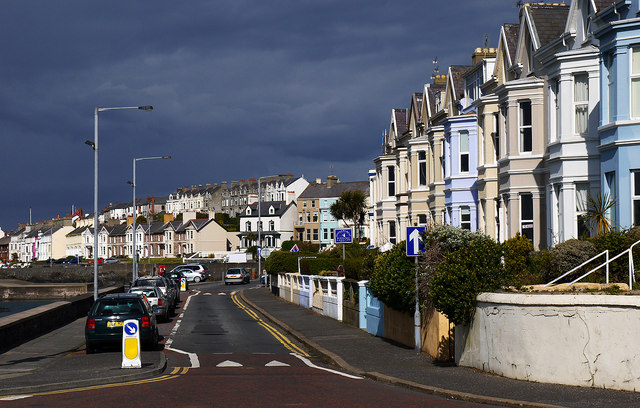
Image: © Rossographer Taken: 12 May 2012
The Seacliff Road in Bangor. All of the terraces here face out towards Belfast Lough and were mostly developed in the latter half of the 19th Century. The terrace on the immediate right is known as Kerrsland Terrace, built c1890. Further along the road can be seen other developments such as Image, Image & Image; the higher terraces beyond are on Victoria Terrace Image and Carisbrooke Terrace Image
Images are licensed for reuse under creativecommons.org/licenses/by-sa/2.0
Image Location
Latitude
54.666008
Longitude
-5.66554