Nottingham - NG3 (Old Sneinton)
Introduction
The photograph on this page of Nottingham - NG3 (Old Sneinton) by David Hallam-Jones as part of the Geograph project.
The Geograph project started in 2005 with the aim of publishing, organising and preserving representative images for every square kilometre of Great Britain, Ireland and the Isle of Man.

There are currently over 7.5m images from over 14,400 individuals and you can help contribute to the project by visiting https://www.geograph.org.uk
Nottingham - NG3 (Old Sneinton)
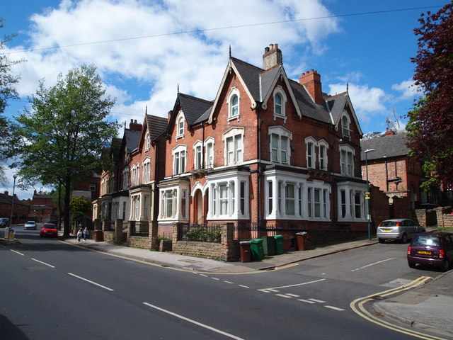
Image: © David Hallam-Jones Taken: 12 May 2012
This series of three-storey late Victorian houses - characterised by large bay windows, ornate barge boards and decorative ridge tiles - are found at the junction of Holroyd Avenue (a cul-de-sac) with Sneinton Dale. The lower end (i.e. the Sneinton Dale end) of Holroyd Avenue has been adopted by the Council but the closed end - higher up the slope - has not.
Images are licensed for reuse under creativecommons.org/licenses/by-sa/2.0
Image Location
Latitude
52.95139
Longitude
-1.128064