Nottingham - NG3 (Old Sneinton)
Introduction
The photograph on this page of Nottingham - NG3 (Old Sneinton) by David Hallam-Jones as part of the Geograph project.
The Geograph project started in 2005 with the aim of publishing, organising and preserving representative images for every square kilometre of Great Britain, Ireland and the Isle of Man.

There are currently over 7.5m images from over 14,400 individuals and you can help contribute to the project by visiting https://www.geograph.org.uk
Nottingham - NG3 (Old Sneinton)
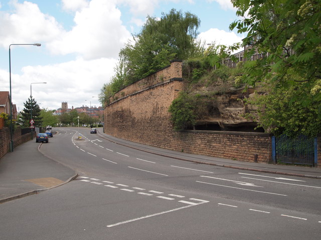
Image: © David Hallam-Jones Taken: 12 May 2012
This is Sneinton Hermitage (a cave site) on a road that is also called Sneinton Hermitage, as seen from Marham Close. Nottingham city centre is visible in the distance. The caves were inhabited until 1867 but in 1897 large parts of their outwardly visible facade were all-but destroyed when the London North Western Railway Company were permitted to develop a goods station on this site so that the rock face and some of the caves had to be cut away.
Images are licensed for reuse under creativecommons.org/licenses/by-sa/2.0
Image Location
Latitude
52.948717
Longitude
-1.131392