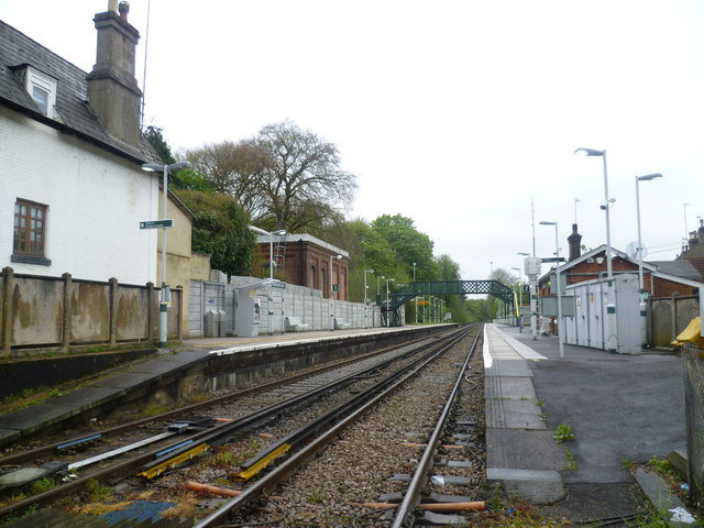
Whyteleafe South station from Salmons Lane level crossing
Introduction
The photograph on this page of Whyteleafe South station from Salmons Lane level crossing by Marathon as part of the Geograph project.
The Geograph project started in 2005 with the aim of publishing, organising and preserving representative images for every square kilometre of Great Britain, Ireland and the Isle of Man.
There are currently over 7.5m images from over 14,400 individuals and you can help contribute to the project by visiting https://www.geograph.org.uk

Image: © Marathon Taken: 9 May 2012
The first proposals for a railway along the Caterham Valley came in 1836 with the object of building a new London to Dover line through a mile long tunnel under the North Downs. It proved too costly and the existing line via Redhill was used. Instead Caterham received a branch line, built by Caterham Railway, a private company, and opened in 1856. The original purpose was to provide a convenient method of transporting the valuable building stone from the quarries at Godstone to London. Soon though the original purpose was overtaken by wealthy Victorian commuters using the line as the Caterham Valley developed. There were early frustrations for these commuters, for example, in the London, Brighton & South Coast Railway arranging for the connecting train at Godstone Road (now Purley) station to leave one minute before the Caterham train arrived. Whyteleafe South station opened at the same time as the line but was called Warlingham until 1956. The single-storey main buildings are on this, the down, side. The narrow gabled station house still exists. This is on the left, next to the level crossing which takes Salmons Lane across the railway. There are three stations in the village of Whyteleafe, the others being Whyteleafe, and Upper Warlingham on the Oxted Line. Whyteleafe station did not open until 1900.

