Nottingham - NG3 (Sneinton)
Introduction
The photograph on this page of Nottingham - NG3 (Sneinton) by David Hallam-Jones as part of the Geograph project.
The Geograph project started in 2005 with the aim of publishing, organising and preserving representative images for every square kilometre of Great Britain, Ireland and the Isle of Man.

There are currently over 7.5m images from over 14,400 individuals and you can help contribute to the project by visiting https://www.geograph.org.uk
Nottingham - NG3 (Sneinton)
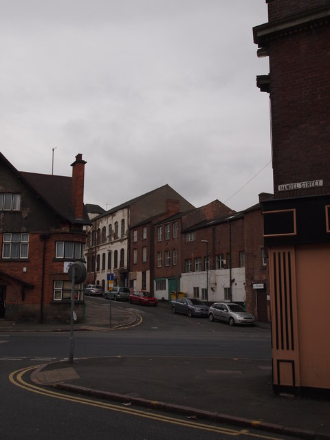
Image: © David Hallam-Jones Taken: 5 May 2012
A view of Dakeyne Street (cul-de-sac) on the other side of the B686, taken from the corner of Handel Street. The street-name sign of the latter is affixed to the corner of The Duke of Devonshire pub whose entrance is on Carlton Road. This pub is still known to some as “The Madhouse” because of the fact that selected patients from The County Lunatic Asylum in Dakeyne Street were allowed to use the pub as a meeting place until the hospital closed in 1902. A plaque near to the pub entrance refers to this.
Images are licensed for reuse under creativecommons.org/licenses/by-sa/2.0
Image Location
Latitude
52.955217
Longitude
-1.135132