Abbey Mill Lane
Introduction
The photograph on this page of Abbey Mill Lane by Ian Capper as part of the Geograph project.
The Geograph project started in 2005 with the aim of publishing, organising and preserving representative images for every square kilometre of Great Britain, Ireland and the Isle of Man.

There are currently over 7.5m images from over 14,400 individuals and you can help contribute to the project by visiting https://www.geograph.org.uk
Abbey Mill Lane
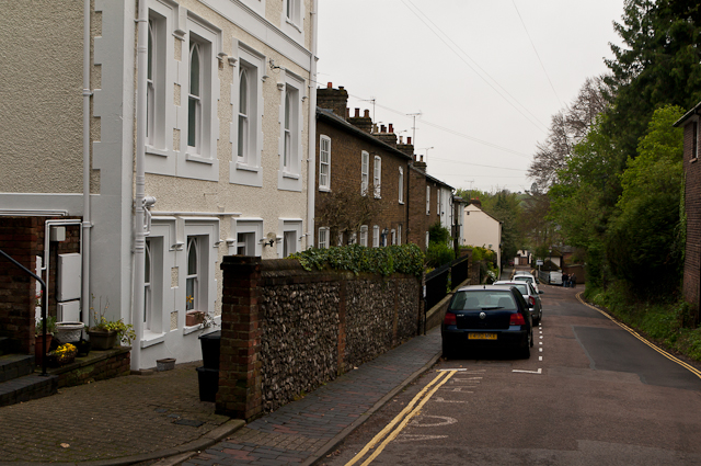
Image: © Ian Capper Taken: 3 May 2012
A road whose original purpose was to link the Abbey with its mill on the River Ver. Most of the housing at the top end of the road are relatively recent by comparison: the building in the foreground is late 19th century and the terraced housing beyond is from the early to mid 19th century. All are locally listed. The protruding white building beyond, no 25, dating from the early 19th century, is grade II listed - see www.historicengland.org.uk/listing/the-list/list-entry/1103166.
Images are licensed for reuse under creativecommons.org/licenses/by-sa/2.0
Image Location


Leaflet Map data © OpenStreetMap
Latitude
51.749986
Longitude
-0.345361