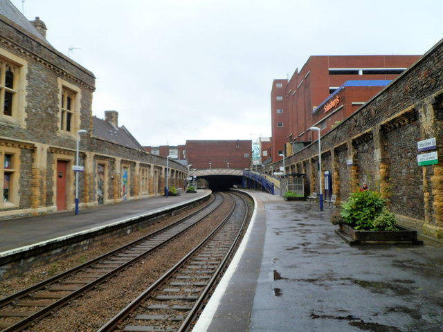
Clifton Down railway station, Bristol
Introduction
The photograph on this page of Clifton Down railway station, Bristol by Jaggery as part of the Geograph project.
The Geograph project started in 2005 with the aim of publishing, organising and preserving representative images for every square kilometre of Great Britain, Ireland and the Isle of Man.
There are currently over 7.5m images from over 14,400 individuals and you can help contribute to the project by visiting https://www.geograph.org.uk

Image: © Jaggery Taken: 7 May 2012
A view east from platform 1. The station is located on the west side of Whiteladies Road, about 6 km (3¾ miles) west of Bristol Temple Meads. The next station ahead is Redland, on the route to Temple Meads. Behind the camera, the next station is Sea Mills, reached through a mile-long tunnel. http://www.geograph.org.uk/photo/1249068 Most trains from Temple Meads end at Avonmouth, with some going on to St Andrews Road and Severn Beach stations. The large building in the background on the right is a Sainsbury's supermarket in Clifton Down Shopping Centre.

