Boundary stone next to The Bridestones
Introduction
The photograph on this page of Boundary stone next to The Bridestones by John Harrison as part of the Geograph project.
The Geograph project started in 2005 with the aim of publishing, organising and preserving representative images for every square kilometre of Great Britain, Ireland and the Isle of Man.

There are currently over 7.5m images from over 14,400 individuals and you can help contribute to the project by visiting https://www.geograph.org.uk
Boundary stone next to The Bridestones
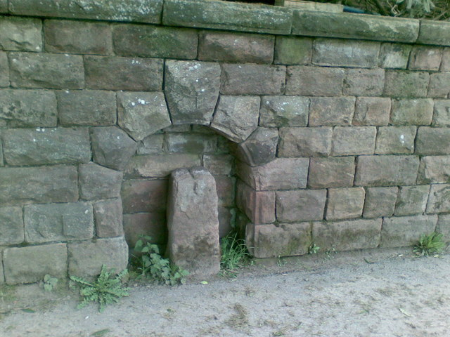
Image: © John Harrison Taken: 5 May 2012
This boundary stone (BS on the map) in the lane to the farm is set in an arch in the wall. It marks the boundary between Cheshire and Staffordshire. It has a cross carved on top and a large letter 'B'.
Images are licensed for reuse under creativecommons.org/licenses/by-sa/2.0
Image Location
Latitude
53.156576
Longitude
-2.14143