Landmark at St Winifred's Well
Introduction
The photograph on this page of Landmark at St Winifred's Well by Des Blenkinsopp as part of the Geograph project.
The Geograph project started in 2005 with the aim of publishing, organising and preserving representative images for every square kilometre of Great Britain, Ireland and the Isle of Man.

There are currently over 7.5m images from over 14,400 individuals and you can help contribute to the project by visiting https://www.geograph.org.uk
Landmark at St Winifred's Well
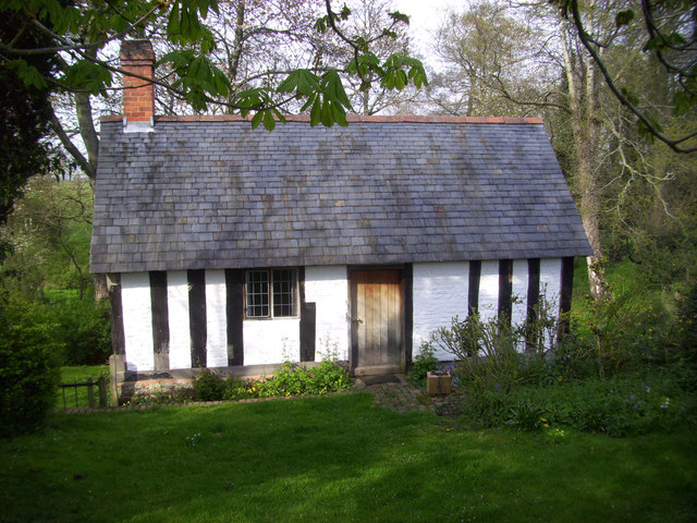
Image: © Des Blenkinsopp Taken: 23 Apr 2012
This ancient building started out as a chapel built above a holy spring. Following the suppression of such superstitious stuff at the reformation the chapel became a manorial court house. The well became popular as a bathing place where as usual people enjoyed themselves so much that in 1755 it had to be closed down to protect them from fun. The building was converted into a cottage which is how it stayed until the Landmark Trust acquired it and added it to their list of attractive and unusual holiday properties.
Images are licensed for reuse under creativecommons.org/licenses/by-sa/2.0
Image Location
Latitude
52.813404
Longitude
-3.007074