Wye Head
Introduction
The photograph on this page of Wye Head by Dave Dunford as part of the Geograph project.
The Geograph project started in 2005 with the aim of publishing, organising and preserving representative images for every square kilometre of Great Britain, Ireland and the Isle of Man.

There are currently over 7.5m images from over 14,400 individuals and you can help contribute to the project by visiting https://www.geograph.org.uk
Wye Head
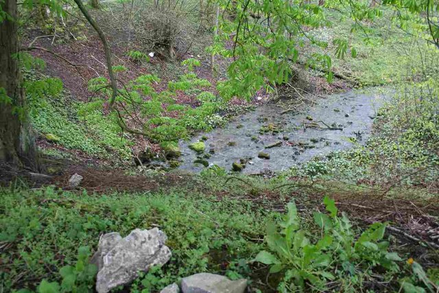
Image: © Dave Dunford Taken: 7 May 2012
One of the main sources of the River Wye, this resurgence is next to a footpath and just below the B5059 (this picture is taken from the pavement). The water disappears from sight in Poole's Cavern and flows to this point through passages impenetrable to cavers.
Images are licensed for reuse under creativecommons.org/licenses/by-sa/2.0
Image Location
Latitude
53.254347
Longitude
-1.926366