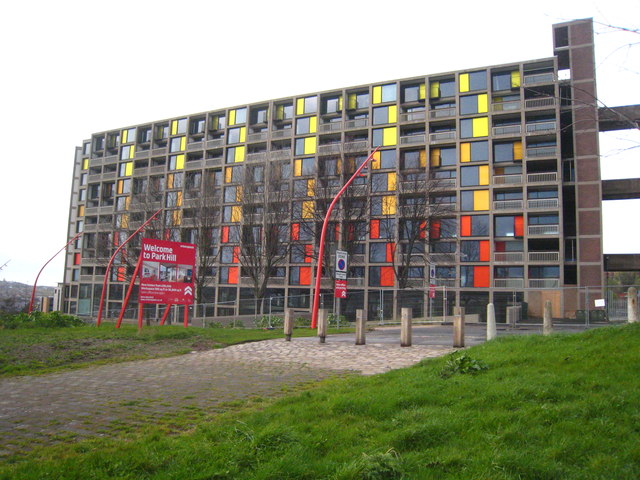
Park Hill flats
Introduction
The photograph on this page of Park Hill flats by Rod Allday as part of the Geograph project.
The Geograph project started in 2005 with the aim of publishing, organising and preserving representative images for every square kilometre of Great Britain, Ireland and the Isle of Man.
There are currently over 7.5m images from over 14,400 individuals and you can help contribute to the project by visiting https://www.geograph.org.uk

Image: © Rod Allday Taken: 4 Apr 2012
Park Hill council housing estate was built between 1957 and 1961. Built in Brutalist style, the flats' 'streets in the sky' deck access layout was revolutionary and copied by later developments. Although initially popular and successful, over time the fabric of the building decayed somewhat and some other disadvantages of the estate, such as poor noise insulation and easy getaway routes for muggers, became apparent. For many years, the council had difficulty finding tenants for the flats. The building was controversially given Grade II* Listing in 1998, becoming the largest listed building in Europe. The flats are currently in the process of redevelopment in a part-privatisation scheme by the developer Urban Splash in partnership with English Heritage to turn the flats into upmarket apartments, business units and social housing.
Image Location


