Nottingham - NG7 (Radford)
Introduction
The photograph on this page of Nottingham - NG7 (Radford) by David Hallam-Jones as part of the Geograph project.
The Geograph project started in 2005 with the aim of publishing, organising and preserving representative images for every square kilometre of Great Britain, Ireland and the Isle of Man.

There are currently over 7.5m images from over 14,400 individuals and you can help contribute to the project by visiting https://www.geograph.org.uk
Nottingham - NG7 (Radford)
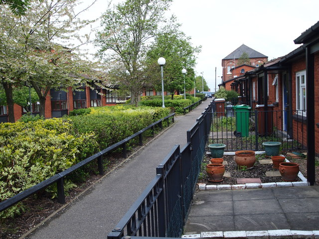
Image: © David Hallam-Jones Taken: 5 May 2012
Alvey Terrace is the name given to this row of bungalows hugging this private footpath and connecting two sections of Forster Street. The bungalows, the path and the maisonettes opposite them are owned by the Wm. Sutton Housing Trust. William Sutton (1833-1900) was a Londoner who made his fortune through door-to-door parcel deliveries (something the Royal Mail was not doing at the time) through his company, Sutton Carriers. After his death most of his wealth went into housing trusts named after him that still provide affordable housing for impoverished people. The former Radford Methodist church, now being used by another Christian church, can be seen in the distance.
Images are licensed for reuse under creativecommons.org/licenses/by-sa/2.0
Image Location
Latitude
52.956049
Longitude
-1.176349