Nauls Mill House, Middleborough Road, Coventry
Introduction
The photograph on this page of Nauls Mill House, Middleborough Road, Coventry by Stephen Richards as part of the Geograph project.
The Geograph project started in 2005 with the aim of publishing, organising and preserving representative images for every square kilometre of Great Britain, Ireland and the Isle of Man.

There are currently over 7.5m images from over 14,400 individuals and you can help contribute to the project by visiting https://www.geograph.org.uk
Nauls Mill House, Middleborough Road, Coventry
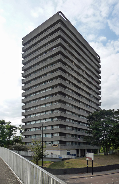
Image: © Stephen Richards Taken: 22 Aug 2011
One of a number of similarly-styled tower blocks dotted about the northern fringes of Coventry, standing like sentries as if to provide early warning of incursions by Nuneaton or Hinckley. They are distinguished by projecting white concrete bands. This was built in 1968 by Terence Gregory, City Architect. Taken from a footbridge over Coventry's apparently omnipresent ring road.
Images are licensed for reuse under creativecommons.org/licenses/by-sa/2.0
Image Location
Latitude
52.413317
Longitude
-1.515674