Nottingham - NG5 (City Hospital)
Introduction
The photograph on this page of Nottingham - NG5 (City Hospital) by David Hallam-Jones as part of the Geograph project.
The Geograph project started in 2005 with the aim of publishing, organising and preserving representative images for every square kilometre of Great Britain, Ireland and the Isle of Man.

There are currently over 7.5m images from over 14,400 individuals and you can help contribute to the project by visiting https://www.geograph.org.uk
Nottingham - NG5 (City Hospital)
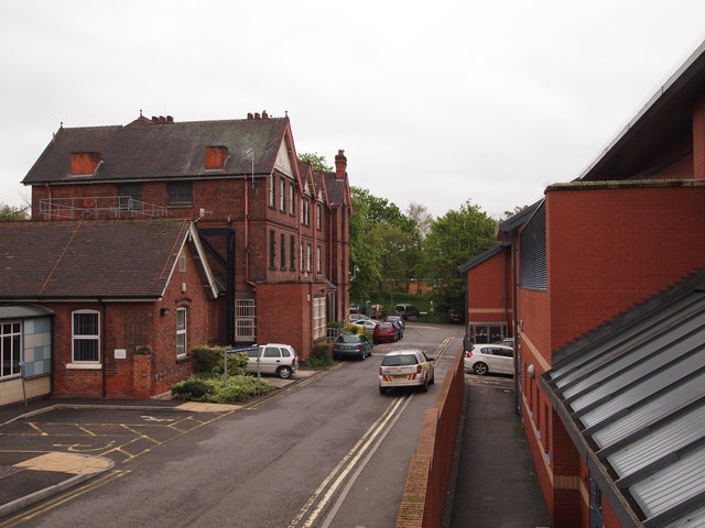
Image: © David Hallam-Jones Taken: 4 May 2012
A stretch of the hospital perimeter road running parallel with Hucknall Rd. The tall Victorian building is Heathfield House, once the administrative office block for Bagthorpe Hospital (the city's isolation hospital, opened in 1892). More recently these office premises have housed the hospital’s IT operations. The smaller building is the Regional Cleft Lip/Palate Centre, whereas the modern building accommodates the P.E.T & C.T Scan Unit.
Images are licensed for reuse under creativecommons.org/licenses/by-sa/2.0
Image Location
Latitude
52.989488
Longitude
-1.163199