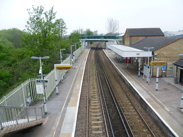
Hackbridge station
Introduction
The photograph on this page of Hackbridge station by Marathon as part of the Geograph project.
The Geograph project started in 2005 with the aim of publishing, organising and preserving representative images for every square kilometre of Great Britain, Ireland and the Isle of Man.
There are currently over 7.5m images from over 14,400 individuals and you can help contribute to the project by visiting https://www.geograph.org.uk

Image: © Marathon Taken: 2 May 2012
The Peckham Rye to Sutton line via Streatham opened in 1868 which is when the station buildings date from. This is looking down the line towards Sutton and as can be seen all the buildings are on the up platform which is the side that everyone has to enter from London Road. There are no houses to the left, just the inaccessible Beddington Farmlands which include a sewage works, gravel workings and landfill sites.

