River Wandle near Culvers Avenue
Introduction
The photograph on this page of River Wandle near Culvers Avenue by Marathon as part of the Geograph project.
The Geograph project started in 2005 with the aim of publishing, organising and preserving representative images for every square kilometre of Great Britain, Ireland and the Isle of Man.

There are currently over 7.5m images from over 14,400 individuals and you can help contribute to the project by visiting https://www.geograph.org.uk
River Wandle near Culvers Avenue
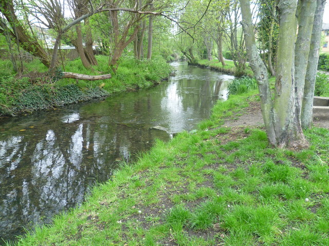
Image: © Marathon Taken: 2 May 2012
Immediately below the Nightingale Road/Hackbridge Road bridge, the Wandle splits into two to form an island which is bisected by Culvers Avenue running east to west. The eastern branch is the main channel and is seen here looking downriver beyond the bridge where Culvers Avenue crosses it. The path on the right is the Wandle Trail.
Images are licensed for reuse under creativecommons.org/licenses/by-sa/2.0
Image Location
Latitude
51.380421
Longitude
-0.161709