River Wandle from Nightingale Road
Introduction
The photograph on this page of River Wandle from Nightingale Road by Marathon as part of the Geograph project.
The Geograph project started in 2005 with the aim of publishing, organising and preserving representative images for every square kilometre of Great Britain, Ireland and the Isle of Man.

There are currently over 7.5m images from over 14,400 individuals and you can help contribute to the project by visiting https://www.geograph.org.uk
River Wandle from Nightingale Road
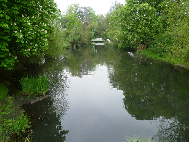
Image: © Marathon Taken: 2 May 2012
This is from the bridge linking Hackbridge Road with Nightingale Road and looks downriver. Just the other side of the tree on the left the Wandle splits into two to form an island with Culvers Avenue bisecting it from east to west. The footbridge in the distance crosses the eastern arm of the river. The Wandle Trail follows the right hand bank.
Images are licensed for reuse under creativecommons.org/licenses/by-sa/2.0
Image Location
Latitude
51.377713
Longitude
-0.161099