The muddy Thames at Sunbury, seen from Rivermead Island
Introduction
The photograph on this page of The muddy Thames at Sunbury, seen from Rivermead Island by Stefan Czapski as part of the Geograph project.
The Geograph project started in 2005 with the aim of publishing, organising and preserving representative images for every square kilometre of Great Britain, Ireland and the Isle of Man.

There are currently over 7.5m images from over 14,400 individuals and you can help contribute to the project by visiting https://www.geograph.org.uk
The muddy Thames at Sunbury, seen from Rivermead Island
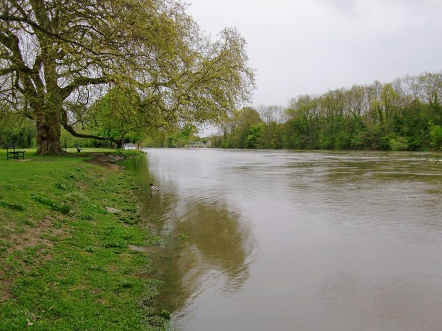
Image: © Stefan Czapski Taken: 2 May 2012
This was the view downstream from Rivermead Island on May 2nd, 2012 - following the wettest April on record. The water level in the river was high (as high as at any time in the last 20 years, according to one local resident) but even more noticeable was the speed of flow and the muddiness of the water. There may be limits to the validity of the comparison, but I'd suggest comparing this shot with Philip Halling's Image - which shows the darker, clearer colour of the Thames in more normal circumstances. Rivermead Island is separated from the mainland by no more than a narrow channel, and is accessible from Thames Street by way of a footbridge. The big tree on the river bank in my shot is a plane - and a particularly fine specimen.
Images are licensed for reuse under creativecommons.org/licenses/by-sa/2.0
Image Location
Latitude
51.407208
Longitude
-0.400035