Wimborne, The Man in the Wall
Introduction
The photograph on this page of Wimborne, The Man in the Wall by Mike Faherty as part of the Geograph project.
The Geograph project started in 2005 with the aim of publishing, organising and preserving representative images for every square kilometre of Great Britain, Ireland and the Isle of Man.

There are currently over 7.5m images from over 14,400 individuals and you can help contribute to the project by visiting https://www.geograph.org.uk
Wimborne, The Man in the Wall
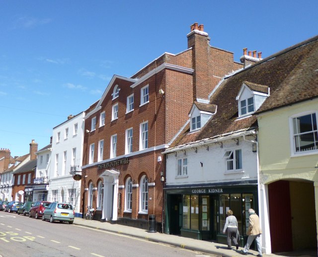
Image: © Mike Faherty Taken: 1 May 2012
Recently opened Wetherspoon's pub in West Borough, formerly the Conservative Club, and before that local government offices. Internally, imposing hall, eating and drinking areas left and right, with left back bar; old mosaic flooring, exposed brickwork, bookcases, games machines, beer garden. Ten cask ales were on offer at my visit, including six locals. The pub's name comes, according to a plaque, from a certain Anthony Ettrick, who decided he was going to die in 1693, had a coffin made with this date, and put in the Minster; he lasted until 1703, so the date had to be changed. The building is listed by English Heritage: http://www.imagesofengland.org.uk/Details/Default.aspx?id=107144&mode=adv http://www.jdwetherspoon.co.uk/home/pubs/the-man-in-the-wall
Images are licensed for reuse under creativecommons.org/licenses/by-sa/2.0
Image Location
Latitude
50.800819
Longitude
-1.988596