Wheat field
Introduction
The photograph on this page of Wheat field by Dave Smethurst as part of the Geograph project.
The Geograph project started in 2005 with the aim of publishing, organising and preserving representative images for every square kilometre of Great Britain, Ireland and the Isle of Man.

There are currently over 7.5m images from over 14,400 individuals and you can help contribute to the project by visiting https://www.geograph.org.uk
Wheat field
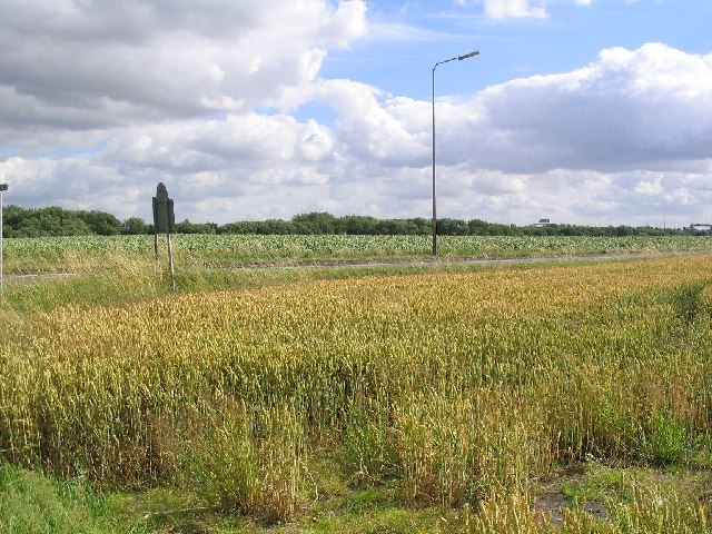
Image: © Dave Smethurst Taken: 20 Jul 2005
This shot is a view across two fields, the near field is of wheat and the field behind is potatoes. The fields are divided by the A57 as it passes from J21 of the M6 towards Rixton. The photo was taken from SJ667893 looking SW towards the M6, some the overhead signs can be seen in the distance.
Images are licensed for reuse under creativecommons.org/licenses/by-sa/2.0
Image Location
Latitude
53.399468
Longitude
-2.502284