
Caer danddaearol Pontardulais / Pontardulais Pill Box
Introduction
The photograph on this page of Caer danddaearol Pontardulais / Pontardulais Pill Box by Alan Richards as part of the Geograph project.
The Geograph project started in 2005 with the aim of publishing, organising and preserving representative images for every square kilometre of Great Britain, Ireland and the Isle of Man.

There are currently over 7.5m images from over 14,400 individuals and you can help contribute to the project by visiting https://www.geograph.org.uk
Caer danddaearol Pontardulais / Pontardulais Pill Box
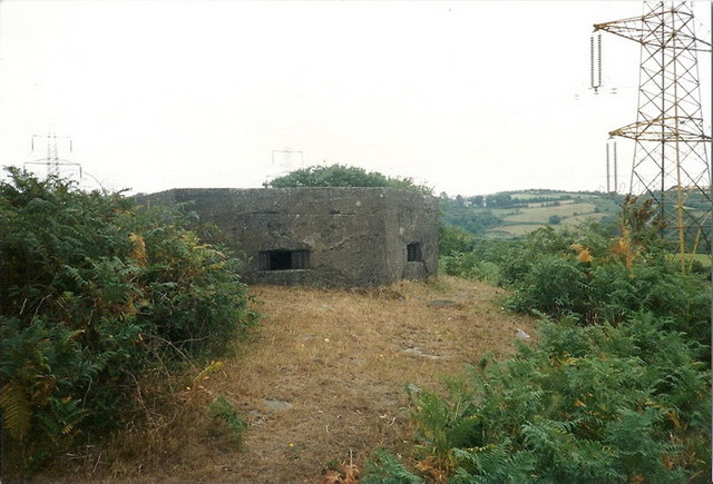
Image: © Alan Richards Taken: 25 Aug 1989
Dyma gaer danddaearol (FW3/22) a leolir ar ben bryn uwchben Ffarm Talfan Fach. Yr enw lleol ar y bryn yw y Graig. Hanner milltir i ffwrdd ceir caer danddaearol arall gerllaw Ffarm Tynybonau. Adeiladwyd miloedd o'r caerau danddaearol hyn ledled Prydain yn ystod yr Ail Ryfel Byd i rwystro unrhyw oresgyniad posibl. A WWII pillbox (Type FW3/22) located on the hill above Talfan Fach Farm. The local name of the hill is Y Graig (The Hill!) There is another pillbox located half a mile away near Tynybonau Farm. Thousands of these pillboxes were built throughout Britain in 1940 in an attempt to thwart any possible invasion.
Images are licensed for reuse under creativecommons.org/licenses/by-sa/2.0
Image Location

Latitude
51.727711
Longitude
-4.039193