Information sign, Coleraine
Introduction
The photograph on this page of Information sign, Coleraine by Willie Duffin as part of the Geograph project.
The Geograph project started in 2005 with the aim of publishing, organising and preserving representative images for every square kilometre of Great Britain, Ireland and the Isle of Man.

There are currently over 7.5m images from over 14,400 individuals and you can help contribute to the project by visiting https://www.geograph.org.uk
Information sign, Coleraine
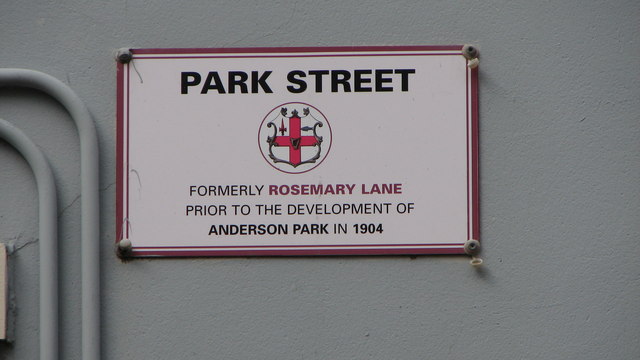
Image: © Willie Duffin Taken: 9 Apr 2012
Park Street was formerly known as Rosemary Lane until the development of Anderson Park in 1904.
Images are licensed for reuse under creativecommons.org/licenses/by-sa/2.0
Image Location
Latitude
55.131724
Longitude
-6.669867