Construction of Affordable Housing
Introduction
The photograph on this page of Construction of Affordable Housing by Nigel Mykura as part of the Geograph project.
The Geograph project started in 2005 with the aim of publishing, organising and preserving representative images for every square kilometre of Great Britain, Ireland and the Isle of Man.

There are currently over 7.5m images from over 14,400 individuals and you can help contribute to the project by visiting https://www.geograph.org.uk
Construction of Affordable Housing
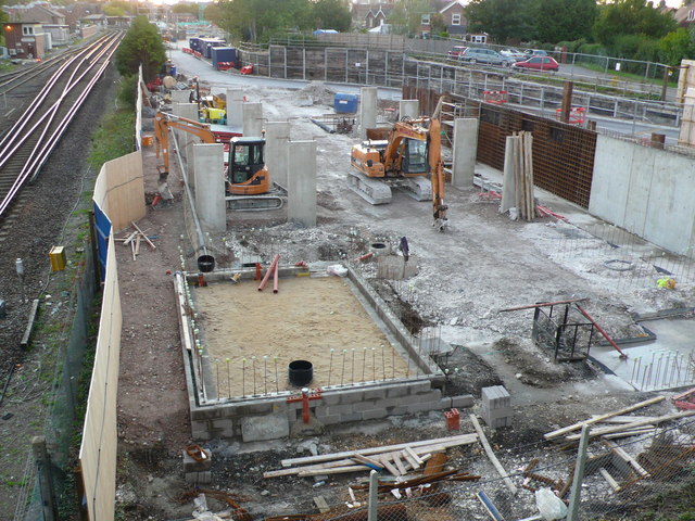
Image: © Nigel Mykura Taken: 18 Sep 2011
This photo shows the construction starting on a block of affordable housing. It is at the very eastern end of the "Brewery Square" development site close to Dorchester South Station. However it has been squeezed onto a tiny patch of land between the railway lines and the eastern access road to the main site, which is not the nicest of locations. In the similar fashion to council houses of the 20th C the not so well off people are pushed to the margins. This only shows the base of the building. When it is finished it will be five storeys high and will dominate the immediate area that has no tall buildings.
Images are licensed for reuse under creativecommons.org/licenses/by-sa/2.0
Image Location
Latitude
50.70946
Longitude
-2.432613