Nottingham - NG7
Introduction
The photograph on this page of Nottingham - NG7 by David Hallam-Jones as part of the Geograph project.
The Geograph project started in 2005 with the aim of publishing, organising and preserving representative images for every square kilometre of Great Britain, Ireland and the Isle of Man.

There are currently over 7.5m images from over 14,400 individuals and you can help contribute to the project by visiting https://www.geograph.org.uk
Nottingham - NG7
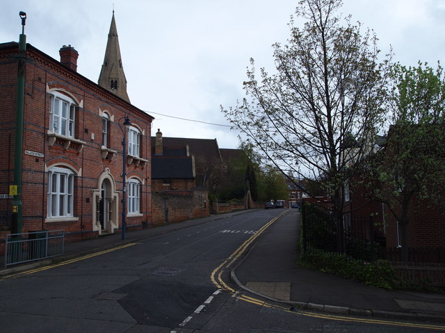
Image: © David Hallam-Jones Taken: 28 Apr 2012
A glance down Raleigh St from the junction with Walter Rd shows an older property and then beyond it, the pitched roofs of the former All Saints' Church school and the spire of the Church. Having been advised by his doctor that he only had 6 mths to live and should consider cycling as a remedial measure Frank Bowden bought a bicycle from a small shop somewhere on Raleigh Street run by Messrs Woodhead, Angois and Ellis. Once on the road to recovery he bought them out and the rest, as they say, is history.
Images are licensed for reuse under creativecommons.org/licenses/by-sa/2.0
Image Location
Latitude
52.959364
Longitude
-1.161845