Stonework detail, Gracehill
Introduction
The photograph on this page of Stonework detail, Gracehill by Kenneth Allen as part of the Geograph project.
The Geograph project started in 2005 with the aim of publishing, organising and preserving representative images for every square kilometre of Great Britain, Ireland and the Isle of Man.

There are currently over 7.5m images from over 14,400 individuals and you can help contribute to the project by visiting https://www.geograph.org.uk
Stonework detail, Gracehill
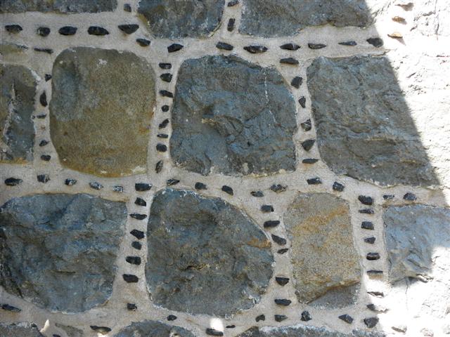
Image: © Kenneth Allen Taken: 28 Apr 2012
Many of the stone buildings, dating from 1768-92 boast unusual details such as galleting, where a decorative line of small stones are pressed into the joints between basalt courses - pictured here Image] More at http://www.bbc.co.uk/northernireland/yourplaceandmine/antrim/gracehill_graves_3.shtml
Images are licensed for reuse under creativecommons.org/licenses/by-sa/2.0
Image Location
Latitude
54.854031
Longitude
-6.327115