Nottingham - NG1
Introduction
The photograph on this page of Nottingham - NG1 by David Hallam-Jones as part of the Geograph project.
The Geograph project started in 2005 with the aim of publishing, organising and preserving representative images for every square kilometre of Great Britain, Ireland and the Isle of Man.

There are currently over 7.5m images from over 14,400 individuals and you can help contribute to the project by visiting https://www.geograph.org.uk
Nottingham - NG1
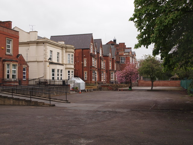
Image: © David Hallam-Jones Taken: 28 Apr 2012
A glance at the rear of the senior section of Nottingham Girls’ High School shows how the school was formed from a number of Victorian houses. The school has obviously expanded considerably and the latest innovation that is being considered is a purpose-built performing arts building. This, however, is proving to be a contentious issue as far as some of the school’s neighbours are concerned given the fact that they are worried about the increased pressure that this will place on the available street parking spaces. Co-incidentally, the school is immediately adjacent to Nottingham High School and some extracurricular activities, such as joint theatrical productions, are organised with the boys from this school.
Images are licensed for reuse under creativecommons.org/licenses/by-sa/2.0
Image Location
Latitude
52.962745
Longitude
-1.157016