Nottingham - NG1
Introduction
The photograph on this page of Nottingham - NG1 by David Hallam-Jones as part of the Geograph project.
The Geograph project started in 2005 with the aim of publishing, organising and preserving representative images for every square kilometre of Great Britain, Ireland and the Isle of Man.

There are currently over 7.5m images from over 14,400 individuals and you can help contribute to the project by visiting https://www.geograph.org.uk
Nottingham - NG1
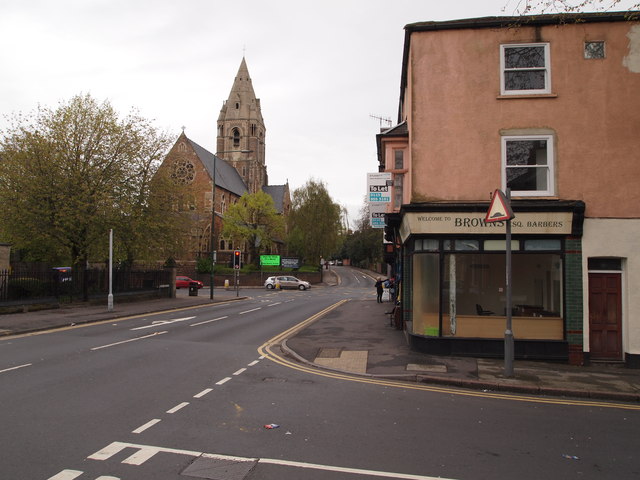
Image: © David Hallam-Jones Taken: 28 Apr 2012
North Sherwood Street joins Forest Road East at this point. “Brown Esq. Barbers” has ceased to function. On the left is the boundary fence of Church (a.k.a. The Rock”) Cemetery and directly ahead, at the junction of Forest Road East and Mansfield Road (A60),‘St Andrew’s on the Rock’, an Anglican parish church is glaringly obvious.
Images are licensed for reuse under creativecommons.org/licenses/by-sa/2.0
Image Location
Latitude
52.964517
Longitude
-1.153259