Boat Inn
Introduction
The photograph on this page of Boat Inn by David Stowell as part of the Geograph project.
The Geograph project started in 2005 with the aim of publishing, organising and preserving representative images for every square kilometre of Great Britain, Ireland and the Isle of Man.

There are currently over 7.5m images from over 14,400 individuals and you can help contribute to the project by visiting https://www.geograph.org.uk
Boat Inn
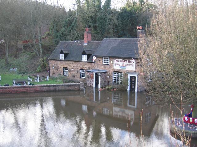
Image: © David Stowell Taken: 8 Dec 2006
The Boat Inn is on the opposite bank of the River Severn to Coalport. As can be seen the river is in flood, and the pub's name could also be taken as an instruction! The marks on the right hand doorway show previous flood levels, and on this occasion the water has not even reached the lowest of these lines so could be construed as a "routine" flood.
Images are licensed for reuse under creativecommons.org/licenses/by-sa/2.0
Image Location
Latitude
52.619393
Longitude
-2.4549