Milton Abbas, The Hambro Arms
Introduction
The photograph on this page of Milton Abbas, The Hambro Arms by Mike Faherty as part of the Geograph project.
The Geograph project started in 2005 with the aim of publishing, organising and preserving representative images for every square kilometre of Great Britain, Ireland and the Isle of Man.

There are currently over 7.5m images from over 14,400 individuals and you can help contribute to the project by visiting https://www.geograph.org.uk
Milton Abbas, The Hambro Arms
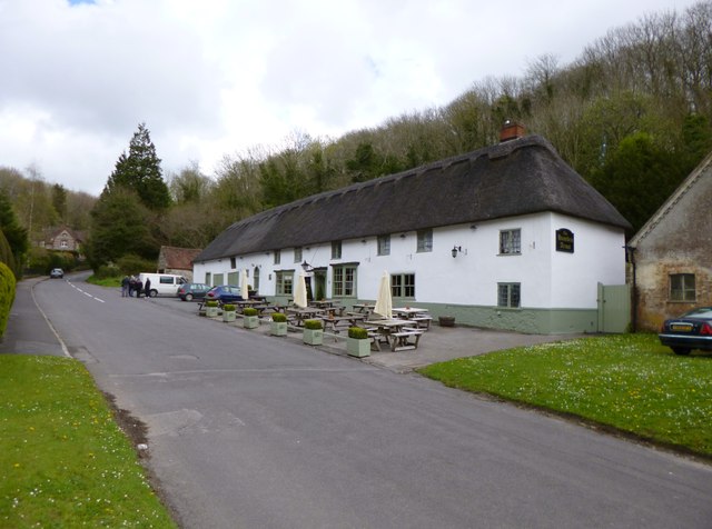
Image: © Mike Faherty Taken: 26 Apr 2012
Thatched pub on the village street; like other properties in the village, built in the late C18 by the Earl of Dorchester, who pulled down the original village, which disturbed his view. Internally, bar to far left, eating and drinking area front, dining right. Open fires, wooden beams, exposed brickwork, at first glance an extensive library in the walls. Cask ales on offer at my visit: Piddle, Ringwood Best, Sharp's Doom Bar. For some customer comments, see http://www.beerintheevening.com/pubs/s/35/35003/Hambro_Arms/Milton_Abbas The building is listed by English Heritage: http://www.imagesofengland.org.uk/Details/Default.aspx?id=103530&mode=adv
Images are licensed for reuse under creativecommons.org/licenses/by-sa/2.0
Image Location


Leaflet Map data © OpenStreetMap
Latitude
50.816505
Longitude
-2.273767