Honeycrock Farm
Introduction
The photograph on this page of Honeycrock Farm by Ian Capper as part of the Geograph project.
The Geograph project started in 2005 with the aim of publishing, organising and preserving representative images for every square kilometre of Great Britain, Ireland and the Isle of Man.

There are currently over 7.5m images from over 14,400 individuals and you can help contribute to the project by visiting https://www.geograph.org.uk
Honeycrock Farm
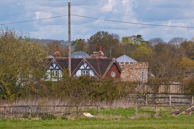
Image: © Ian Capper Taken: 22 Apr 2012
This castellated house caused controversy after it was built in around 2002 without planning permission, having been concealed behind hay bales which were only removed in 2006. Although the owner had argued that by 4 year gap meant that the need for planning permission had passed, the counter argument was put that the hay bales constituted an integral part of the construction process, and so the building was therefore not completed until 2006. Demolition of the property was ordered, and the local council's view was ratified by the High Court when the case went to appeal. For one press report see http://www.telegraph.co.uk/news/uknews/7145967/A-farmer-who-secretly-built-castle-behind-straw-bales-ordered-to-demolish-it.html and for the council's statement see http://81.150.212.1/planning/planning_enforcement/honeycrockfarm/. Even so, the building is still in place in this 2012 photo.
Images are licensed for reuse under creativecommons.org/licenses/by-sa/2.0
Image Location
Latitude
51.204791
Longitude
-0.150257