Skipton Toll House
Introduction
The photograph on this page of Skipton Toll House by John Illingworth as part of the Geograph project.
The Geograph project started in 2005 with the aim of publishing, organising and preserving representative images for every square kilometre of Great Britain, Ireland and the Isle of Man.

There are currently over 7.5m images from over 14,400 individuals and you can help contribute to the project by visiting https://www.geograph.org.uk
Skipton Toll House
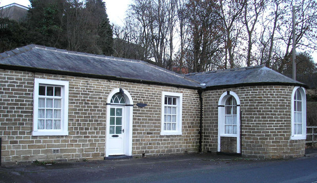
Image: © John Illingworth Taken: 9 Dec 2006
Dating from about 1755, this is the toll house on the Skipton to Ilkley turnpike. The right-hand end has windows facing both ways along the road.
Images are licensed for reuse under creativecommons.org/licenses/by-sa/2.0
Image Location


Leaflet Map data © OpenStreetMap
Latitude
53.958688
Longitude
-2.00606