The lane to Corwen and a bridleway
Introduction
The photograph on this page of The lane to Corwen and a bridleway by John Haynes as part of the Geograph project.
The Geograph project started in 2005 with the aim of publishing, organising and preserving representative images for every square kilometre of Great Britain, Ireland and the Isle of Man.

There are currently over 7.5m images from over 14,400 individuals and you can help contribute to the project by visiting https://www.geograph.org.uk
The lane to Corwen and a bridleway
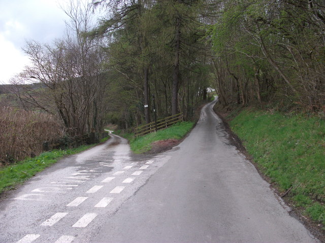
Image: © John Haynes Taken: 23 Apr 2012
The lane to Corwen on the right was the main road north of the river before the A5 Toll Road was built in the early 19th Century. It was still used a lot after this by people who couldn't or wouldn't pay the toll. The bridleway to the left takes a different route beside the river but they rejoin after 1km. The bridleway appears to be a "road" but it is an access road to Groeslwyd only and is closed to traffic apart from horses and walkers. Image]
Images are licensed for reuse under creativecommons.org/licenses/by-sa/2.0
Image Location
Latitude
52.986211
Longitude
-3.233344