Nottingham - NG1
Introduction
The photograph on this page of Nottingham - NG1 by David Hallam-Jones as part of the Geograph project.
The Geograph project started in 2005 with the aim of publishing, organising and preserving representative images for every square kilometre of Great Britain, Ireland and the Isle of Man.

There are currently over 7.5m images from over 14,400 individuals and you can help contribute to the project by visiting https://www.geograph.org.uk
Nottingham - NG1
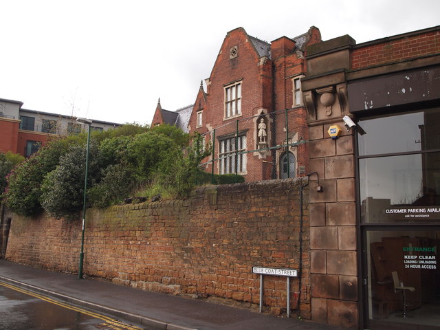
Image: © David Hallam-Jones Taken: 21 Apr 2012
The corner of Bluecoat Street at its junction with Mansfield Road (A60) hosts one of the Bluecoat School's previous sites. The former school building was designed by Thomas Hines in Elizabethan style - with mullioned windows - and was opened in 1853. There are statues of a boy and a girl in traditional school uniform in corner niches in the front elevation. The school continued to function here until 1967 when new premises were opened in Aspley Lane. Today the building is the home of the Y.M.C.A. International Community Centre.
Images are licensed for reuse under creativecommons.org/licenses/by-sa/2.0
Image Location
Latitude
52.95999
Longitude
-1.148733