Nottingham - NG5
Introduction
The photograph on this page of Nottingham - NG5 by David Hallam-Jones as part of the Geograph project.
The Geograph project started in 2005 with the aim of publishing, organising and preserving representative images for every square kilometre of Great Britain, Ireland and the Isle of Man.

There are currently over 7.5m images from over 14,400 individuals and you can help contribute to the project by visiting https://www.geograph.org.uk
Nottingham - NG5
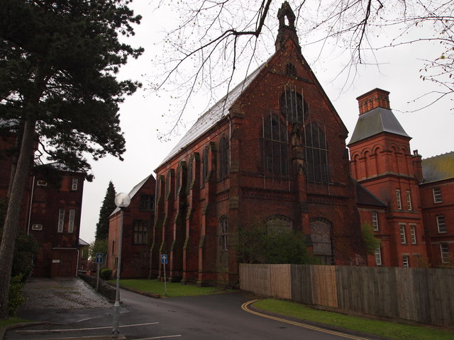
Image: © David Hallam-Jones Taken: 21 Apr 2012
This former chapel and recreation hall block, together with the wooden fence, form the boundary between what was once Mapperley mental hospital – much of which has been redeveloped into the “City Heights” housing complex – and the remaining part of the site that continues to function as a much smaller mental health unit. This view from the north west shows an internal hospital road that is used for vehicles accessing the rear of "Duncan Macmillan House". This imposing two-storey building is constructed of brick with a pitched slate roof, the former chapel occupying the upper part of it and the former recreation hall the ground floor unit, both constructed as separate entities. This twin-purpose block was completed in 1888 as part of a further extension of the hospital’s capacity. Further information can be found at www2.warwick.ac.uk/fac/arts/arthistory/research/staffinterests/ja/alexander.pdf
Images are licensed for reuse under creativecommons.org/licenses/by-sa/2.0
Image Location
Latitude
52.978432
Longitude
-1.125881