Bannerman's Bridge
Introduction
The photograph on this page of Bannerman's Bridge by Colin Smith as part of the Geograph project.
The Geograph project started in 2005 with the aim of publishing, organising and preserving representative images for every square kilometre of Great Britain, Ireland and the Isle of Man.

There are currently over 7.5m images from over 14,400 individuals and you can help contribute to the project by visiting https://www.geograph.org.uk
Bannerman's Bridge
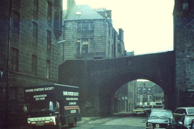
Image: © Colin Smith Taken: 1 Apr 1982
Old road bridge carrying Marischal Street over Virginia Street in Aberdeen - taken shortly before the bridge was demolished and rebuilt across a dualled Virginia Street. Note the Shore Porters' Society removals lorry - their base was here in Virginia Street before being moved to nearby Baltic Place. Established in 1498, the porters [originally pynours] carried goods between the town and harbour. www.aberdeencity.gov.uk
Images are licensed for reuse under creativecommons.org/licenses/by-sa/2.0
Image Location
Latitude
57.147103
Longitude
-2.09253