Watercolour
Introduction
The photograph on this page of Watercolour by Ian Capper as part of the Geograph project.
The Geograph project started in 2005 with the aim of publishing, organising and preserving representative images for every square kilometre of Great Britain, Ireland and the Isle of Man.

There are currently over 7.5m images from over 14,400 individuals and you can help contribute to the project by visiting https://www.geograph.org.uk
Watercolour
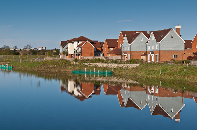
Image: © Ian Capper Taken: 21 Apr 2012
A major housing development on the site of the old Holmethorpe sand quarry, marketed as Watercolour. The lake was landscaped from the quarry itself and is now a nature reserve. Running across the left background of the photo is the "Quarry Line" - the section of the London to Brighton railway bypassing Redhill. Behind this is part of another recent development, Park 25 (see Image), and beyond this is The Dome (see Image).
Images are licensed for reuse under creativecommons.org/licenses/by-sa/2.0
Image Location
Latitude
51.250072
Longitude
-0.151493