Nottingham - NG5
Introduction
The photograph on this page of Nottingham - NG5 by David Hallam-Jones as part of the Geograph project.
The Geograph project started in 2005 with the aim of publishing, organising and preserving representative images for every square kilometre of Great Britain, Ireland and the Isle of Man.

There are currently over 7.5m images from over 14,400 individuals and you can help contribute to the project by visiting https://www.geograph.org.uk
Nottingham - NG5
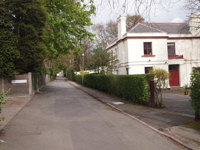
Image: © David Hallam-Jones Taken: 22 Apr 2012
A view of Private Road from the A60 (Mansfield Road, Sherwood) end showing one of its largest and oldest Victorian mansions. The road continues uphill towards the B684 (the Woodborough Road/Mapperley Top area). A certain Samuel Cartledge owned the Mapperley Place Estate that surrounds what is now known as Private Road up to and including Mapperley Mount at the top of this hilly road. He also owned a nearby brickyard and its associated cottages. According to the Poll Book of 1832 nine voters lived alongside this private road and three lived in the "Plains" or the Brickyard Cottages. The Mapperley cricket field was also off Private Road in distant times.
Images are licensed for reuse under creativecommons.org/licenses/by-sa/2.0
Image Location
Latitude
52.978819
Longitude
-1.141959