Nottingham - NG5/NG3 boundary
Introduction
The photograph on this page of Nottingham - NG5/NG3 boundary by David Hallam-Jones as part of the Geograph project.
The Geograph project started in 2005 with the aim of publishing, organising and preserving representative images for every square kilometre of Great Britain, Ireland and the Isle of Man.

There are currently over 7.5m images from over 14,400 individuals and you can help contribute to the project by visiting https://www.geograph.org.uk
Nottingham - NG5/NG3 boundary
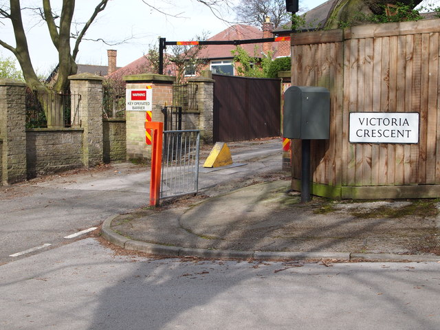
Image: © David Hallam-Jones Taken: 22 Apr 2012
A view of the traffic control barrier situated at the halfway point on Private Road (sic), adjacent to Victoria Crescent. This picture was taken from the Mansfield Road end of this semi-private road. (No. 32, Victoria Crescent, a stone’s throw away from this barrier is where D.H. Lawrence lodged between 1906-08 whilst he was a trainee-teacher student at University College, Nottingham.) This electronic barrier was installed circa 1997 to replace a wooden gate that, whilst effective in deterring unauthorised traffic, became a nuisance for local residents using their cars. A certain Samuel Cartledge owned the Mapperley Place Estate that surrounds what is now called Private Road, up to and including Mapperley Mount at the top end of this hilly road. He also owned a nearby brickyard and its associated cottages. According to the Poll Book of 1832 nine voters lived alongside this private road and three others lived in the "Plains" or the Brickyard Cottages. The Mapperley cricket field was previously just off Private Road too.
Images are licensed for reuse under creativecommons.org/licenses/by-sa/2.0
Image Location
Latitude
52.979426
Longitude
-1.138968