Nounsley Ford
Introduction
The photograph on this page of Nounsley Ford by Essex Walks as part of the Geograph project.
The Geograph project started in 2005 with the aim of publishing, organising and preserving representative images for every square kilometre of Great Britain, Ireland and the Isle of Man.

There are currently over 7.5m images from over 14,400 individuals and you can help contribute to the project by visiting https://www.geograph.org.uk
Nounsley Ford
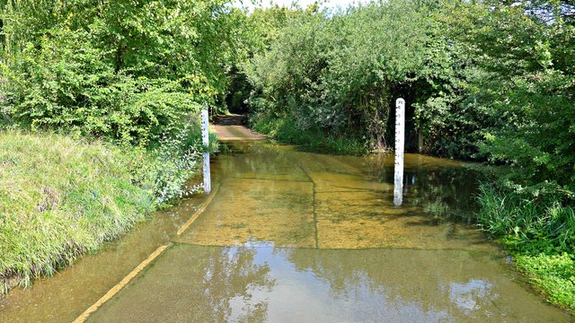
Image: © Essex Walks Taken: 19 Aug 2011
Ford at River Ter. It is possible the River Ter was known as the 'Ult' in Anglo-Saxon times. Hence nearby Ulting village was known as the Ult - ingas (settlers near this place). Ref: http://www.essexwalks.com/walks/ulting.html
Images are licensed for reuse under creativecommons.org/licenses/by-sa/2.0
Image Location
Latitude
51.761325
Longitude
0.600772