Nottingham - NG3
Introduction
The photograph on this page of Nottingham - NG3 by David Hallam-Jones as part of the Geograph project.
The Geograph project started in 2005 with the aim of publishing, organising and preserving representative images for every square kilometre of Great Britain, Ireland and the Isle of Man.

There are currently over 7.5m images from over 14,400 individuals and you can help contribute to the project by visiting https://www.geograph.org.uk
Nottingham - NG3
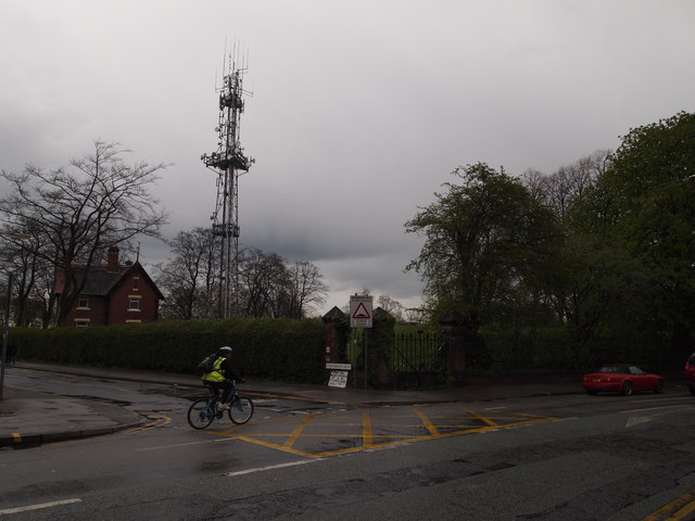
Image: © David Hallam-Jones Taken: 20 Apr 2012
A cyclist peddling along Woodborough Road (B684) in the direction of Mapperley at the junction of Woodthorpe Road on a wet April afternoon. The Mapperley Ridge radio transmitter towers above everything else. Adjacent to the transmitter is a brick-built house belonging to the Severn-Trent Water Authority and behind the (now unused) gates the raised profile of a covered reservoir can be seen.
Images are licensed for reuse under creativecommons.org/licenses/by-sa/2.0
Image Location
Latitude
52.981588
Longitude
-1.127158