Nottingham - NG3
Introduction
The photograph on this page of Nottingham - NG3 by David Hallam-Jones as part of the Geograph project.
The Geograph project started in 2005 with the aim of publishing, organising and preserving representative images for every square kilometre of Great Britain, Ireland and the Isle of Man.

There are currently over 7.5m images from over 14,400 individuals and you can help contribute to the project by visiting https://www.geograph.org.uk
Nottingham - NG3
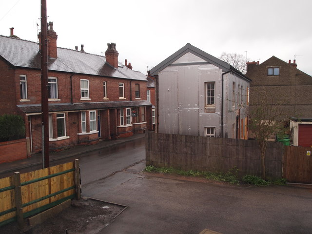
Image: © David Hallam-Jones Taken: 20 Apr 2012
A view of the cul-de-sac known as Belvoir Street. Almost opposite where it joins Woodborough Road (B684) Mapperley Community can be seen, occupying a single storey brick building that was previously part of the local brick factory that once produced the bricks for St Pancras Station, amongst other buildings. It seems likely that at least some of the terraced houses in Belvoir Street would have been occupied by employees from this nearby factory. It also seems possible that the larger property in the centre of the picture (currently being insulated externally) may have housed the family of one of the brick company's more senior employees?
Images are licensed for reuse under creativecommons.org/licenses/by-sa/2.0
Image Location
Latitude
52.980527
Longitude
-1.129563