Isleworth Ait
Introduction
The photograph on this page of Isleworth Ait by Martin Addison as part of the Geograph project.
The Geograph project started in 2005 with the aim of publishing, organising and preserving representative images for every square kilometre of Great Britain, Ireland and the Isle of Man.

There are currently over 7.5m images from over 14,400 individuals and you can help contribute to the project by visiting https://www.geograph.org.uk
Isleworth Ait
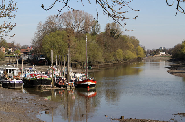
Image: © Martin Addison Taken: 6 Apr 2012
Looking down river on the Thames. The main flow of the river is to the east of the island. The channel to the west of the island is dry at the upstream end at low tide and a number of houseboats are moored in it and at the southern end.
Images are licensed for reuse under creativecommons.org/licenses/by-sa/2.0
Image Location
Latitude
51.464821
Longitude
-0.320856