Old lodge gatepost
Introduction
The photograph on this page of Old lodge gatepost by Lairich Rig as part of the Geograph project.
The Geograph project started in 2005 with the aim of publishing, organising and preserving representative images for every square kilometre of Great Britain, Ireland and the Isle of Man.

There are currently over 7.5m images from over 14,400 individuals and you can help contribute to the project by visiting https://www.geograph.org.uk
Old lodge gatepost
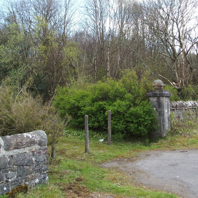
Image: © Lairich Rig Taken: 13 Apr 2012
At this point, a greatly overgrown track heads north-east, away from the main road. The presence of an elaborate gatepost suggested that there might once have been a lodge here. The lodge is shown on the first-edition OS map (c.1860); as later maps reveal, it was called Mid Lodge, and, as that name suggests, it was one of three that were associated with Camis Eskan House (Image). It was located in roughly the same place as the dense clump of vegetation that can be seen beside the gatepost. The other two lodges survive: Image and Image
Images are licensed for reuse under creativecommons.org/licenses/by-sa/2.0
Image Location


Leaflet Map data © OpenStreetMap
Latitude
55.991628
Longitude
-4.695787