Gloucester Community Church, Gloucester
Introduction
The photograph on this page of Gloucester Community Church, Gloucester by Jaggery as part of the Geograph project.
The Geograph project started in 2005 with the aim of publishing, organising and preserving representative images for every square kilometre of Great Britain, Ireland and the Isle of Man.

There are currently over 7.5m images from over 14,400 individuals and you can help contribute to the project by visiting https://www.geograph.org.uk
Gloucester Community Church, Gloucester
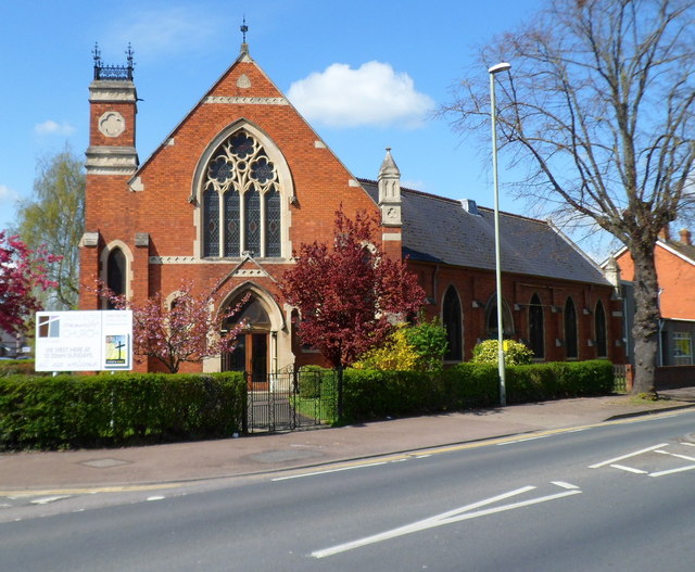
Image: © Jaggery Taken: 13 Apr 2012
Located on the corner of Stroud Road and Robinson Road. http://www.geograph.org.uk/photo/2905472 to a side view Originally named The Bible Christian Methodist Chapel, the foundation stones were laid in December 1903. The construction included a school, which opened in May 1904. The chapel opened in October 1904. In 1907 the chapel was renamed Stroud Road United Methodist Church. In 1955, it became St Luke's Methodist Chapel. In 2008 it was sold by the Methodist Church, and is now Gloucester Community Church.
Images are licensed for reuse under creativecommons.org/licenses/by-sa/2.0
Image Location
Latitude
51.852239
Longitude
-2.243862